The project of "research and application of key technologies of geomorphic type classification and accurate division" led by researcher cheng weiming of the institute
Source: | Date:2017-11-13 | 【Print】 【Close】
From November 8 to 10, the 2017 academic annual meeting of the Chinese society of surveying, mapping and geographic information and the 11th national congress of its members were held in nanjing.More than 2,700 people attended the conference, including jiangsu provincial people's government, China association for science and technology, national administration of surveying, mapping and geographic information, famous academicians at home and abroad, leaders of China association of surveying, mapping and geographic information, members of provincial geographic information association, experts and scholars, and enterprise members.The 2017 surveying and mapping science and technology progress award was announced at the same time, including 6 special prizes, 13 first prizes, 54 second prizes and 73 third prizes.
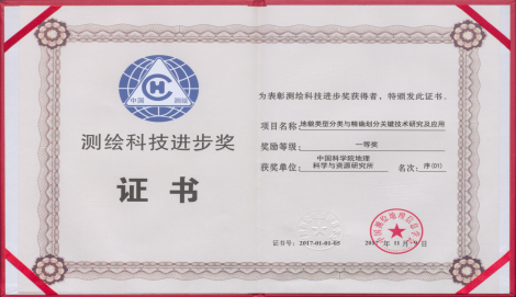
The project of "research and application of key technologies of geomorphic type classification and accurate division" led by researcher cheng weiming of the institute of geographical resources won the first prize of 2017 surveying and mapping science and technology progress award.The project was completed by the institute of geographical sciences and resources of the Chinese academy of sciences, Chinese academy of surveying and mapping, taiyuan university of technology, xinjiang institute of ecology and geography of the Chinese academy of sciences, institute of surveying and geophysics of the Chinese academy of sciences and northeast normal university.Geographic resources for Cheng Weiming prize winners (ranked first), member of jiancheng luo, a researcher at the (second), the researcher cheng-zhi qin (fourth), researcher xiao-mei Yang (sixth) and ming-guo zheng, deputy researcher (no. 12), Wang Suiji associate professor (no. 13), deputy researcher yong-hui yao (14th).Researcher cheng weiming received the award as the representative of the winning team.
Geomorphic type unit is the most basic element in geographical unit system.Geomorphic research team won the second prize of national science and technology progress since 2009, the China 1:10 00000 digital geomorphologic map research and application, further carry out the multi-scale landscape type classification theory system, established the geomorphic type unit accurately dividing method system, carried out the national provincial 1:100000 demonstration study of the classification of the landform, reveals the pattern of the typical regional geomorphic characteristics and change.
Major technical innovations of the project include:
1.A multi-scale classification system of geomorphic types and a coding system of geomorphic types with a hierarchical system are established, which combines morphology with genesis and type with structure.
2.Based on the prototype theory and DEM data, the automatic recognition and accurate classification method of terrain slope spatial gradient features, terrain elements, terrain indexes, geomorphic morphologic type entity units, etc.
3.Based on the features of color, texture and structure of multi-source remote sensing image, the terrain type recognition model and accurate classification method are established.
4.The division method and model of multi-scale geomorphic type unit are established, the specification and technical process of precise location of geomorphic type unit are constructed, and the database system of national multi-scale geomorphic type is established.
5.The types, characteristics and spatial distribution patterns of alpine glaciers and periglacial landforms in the qinghai-tibet plateau are comprehensively and systematically revealed.
The basic content of landscape type is not only the geographical state of the census, geographical conditions and other factors and controlling boundary, the basis of statistical analysis to carry out the landscape type classification system and accurate segmentation study is the must of geographical survey and monitoring the state of the union, and the results of the study's geographical conditions census geomorphic type precise positioning of the surveying and mapping industry specification provides an important theoretical and technical support.